Elev Group Pty Ltd
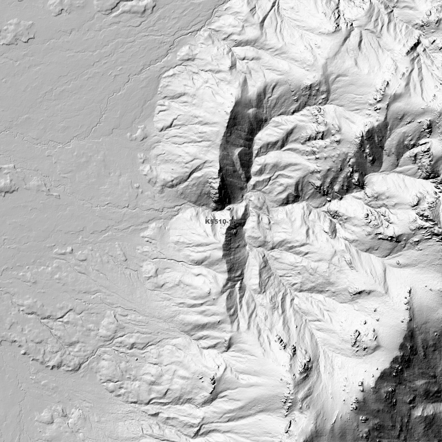
Algonkian 1m Digital Elevation Model (K5510-13)
Algonkian 1m Digital Elevation Model (K5510-13)
Couldn't load pickup availability
Algonkian 1m Digital Elevation Model (K5510-13) – High-Precision Digital Elevation Model Data which has been highly curated and ready for use.
Elev Group presents our high-resolution Algonkian 1m Digital Elevation Model (DEM)—an easy-to-access resource for professionals needing precise terrain data for mapping, modelling, and spatial analysis.
What is in your Download?
- 1 Metre resolution Digital Elevation Model (Geotiff format)
- Full Metadata Statement (PDF document)
- Metadata Index Dataset (ESRI Shapefile)
- Copies of original Metadata from each contributing data survey
Data Source Attribution: The 1m DEM is compiled from a variety of authoritative sources, with each pixel representing the most current elevation data for consistent and accurate geospatial analysis.
Algonkian 1m DEM (K5510-13) compiled with data supplied by The Department of Natural Resources and Environment Tasmania.
Note: Data Holes Exist within Source Datasets
Projection: Zone 55 Map Grid of Australia and Datum: GDA2020
Locations
State and Territories: Tasmania
Locations within the area; Algonkian Mountain, Banana Lake, Bayeux Bluff, Domesday Bluff, Hereward Crag, Innes High Rocky, Iris Ponds, King Charles Head, Lake Anne, Lake Eleanor, Lake King William, Lake Lancaster, Lake Richmond, Lake Rufus, Lake Sally Jane, Lake Stuart, Lake Tudor, Lake Vincent, Lake Warwick, Lake York, Loddon Bluff, Mount Hobhouse, Mount King William II, Mount King William III, Needle Rock Tarn, Owens Tarn, Prince Rupert Pools, Rouen Tarn, Surprise Tarn, Tudor Crag
Share