Elev Group Pty Ltd
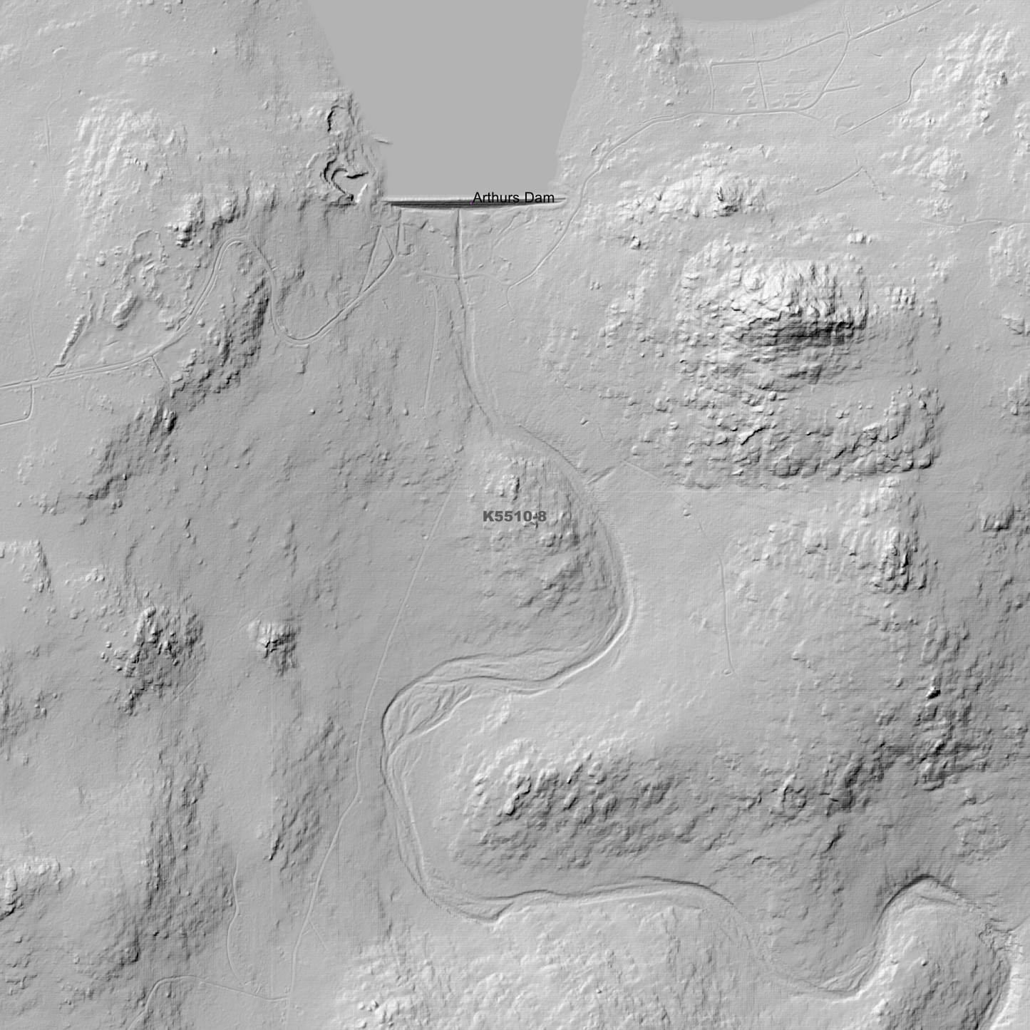
Allwrights 1m Digital Elevation Model (K5510-8)
Allwrights 1m Digital Elevation Model (K5510-8)
Couldn't load pickup availability
Allwrights 1m Digital Elevation Model (K5510-8) – High-Precision Digital Elevation Model Data which has been highly curated and ready for use.
Elev Group presents our high-resolution Allwrights 1m Digital Elevation Model (DEM)—an easy-to-access resource for professionals needing precise terrain data for mapping, modelling, and spatial analysis.
What is in your Download?
- 1 Metre resolution Digital Elevation Model (Geotiff format)
- Full Metadata Statement (PDF document)
- Metadata Index Dataset (ESRI Shapefile)
- Copies of original Metadata from each contributing data survey
Data Source Attribution: The 1m DEM is compiled from a variety of authoritative sources, with each pixel representing the most current elevation data for consistent and accurate geospatial analysis.
Allwrights 1m DEM (K5510-8) compiled with data supplied by The Department of Natural Resources and Environment Tasmania.
Note: Data Holes Exist within Source Datasets.
Projection: Zone 55 Map Grid of Australia and Datum: GDA2020
Locations
State and Territories: Tasmania
Locations within the area; Allwrights Lagoons, Arthurs Dam, Arthurs Lake, Big Burns Lagoon, Fourth Lagoon, Hellfire Gully, Hilltop, Lagoon of Islands, Lake Duncan, Lake Lynch, Millers Gully, Morass Bay, Mount Hay, Mount Penny West, North Wall, Penstock Lagoon, Penstock Levee 1, Penstock Levee 2, Rocky Gully, Shannon, Sonning Lagoon, Steppes, Waddamana, Wihareja Lagoon, Wilburville, Wire Run Lagoon.
Share