Elev Group Pty Ltd
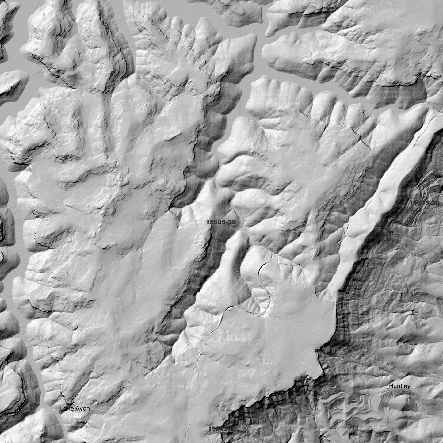
Bargo 1m Digital Elevation Model (I5605-38)
Bargo 1m Digital Elevation Model (I5605-38)
Couldn't load pickup availability
Bargo 1m Digital Elevation Model (I5605-38) – High-Precision Digital Elevation Model Data which has been highly curated and ready for use.
Elev Group presents our high-resolution Bargo 1m Digital Elevation Model (DEM)—an easy-to-access resource for professionals needing precise terrain data for mapping, modelling, and spatial analysis.
What is in your Download
- 1 Metre resolution Digital Elevation Model (Geotiff format)
- Full Metadata Statement (PDF document)
- Metadata Index Dataset (ESRI Shapefile)
- Copies of original Metadata from each contributing data survey
Data Source Attribution: The 1m DEM is compiled from a variety of authoritative sources, with each pixel representing the most current elevation data for consistent and accurate geospatial analysis.
Bargo 1mDEM (I5605-38) compiled with data supplied by NSW Government - Spatial Services.
Note: Data Gaps and Holes Exist Within Source Datasets
Projection: Zone 56 Map Grid of Australia and Datum: GDA2020
Locations
State and Territories: New South Wales
Locations within the area; Cordeaux Dam, Nepean Dam, Avon Dam, Lake Nepean, Buxton, Yerrinbool, Balmoral, Bargo, Browns Road, Cupitts Forest, The Racecourse, Hambridge, Pearsons Selection, Lake Avon, Mount Lindsey, Colo, Dendrobium, Burke, Bargo, Wongawilli, Wilton, Banksia, Mittagong, Yerrinbool, Balmoral, Bargo, Avon, Huntley, Buxton, Yanderra, Mount Lindsey, Alpine
Share