Elev Group Pty Ltd
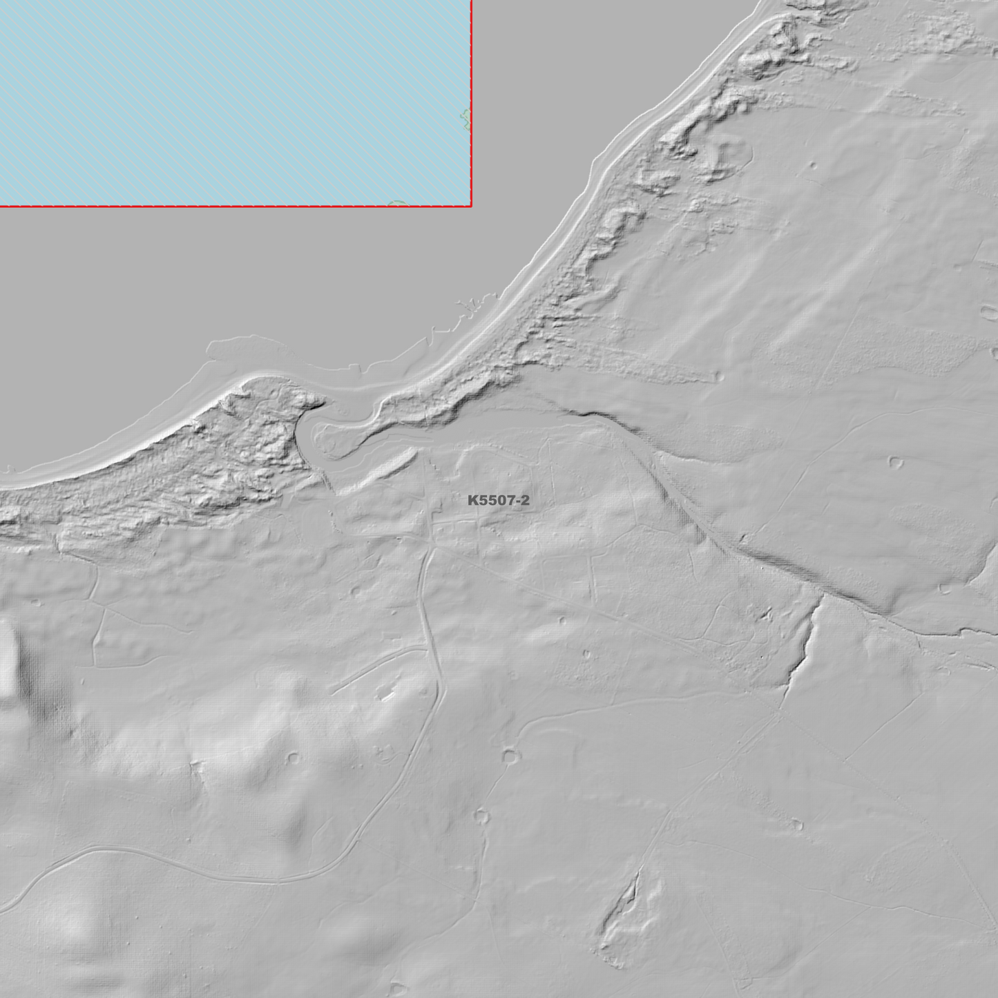
Bell Bay 1m Digital Elevation Model (K5507-2)
Bell Bay 1m Digital Elevation Model (K5507-2)
Couldn't load pickup availability
Bell Bay 1m Digital Elevation Model (K5507-2) – High-Precision Digital Elevation Model Data which has been highly curated and ready for use.
Elev Group presents our high-resolution Bell Bay 1m Digital Elevation Model (DEM)—an easy-to-access resource for professionals needing precise terrain data for mapping, modelling, and spatial analysis.
What is in your Download?
- 1 Metre resolution Digital Elevation Model (Geotiff format)
- Full Metadata Statement (PDF document)
- Metadata Index Dataset (ESRI Shapefile)
- Copies of original Metadata from each contributing data survey
Data Source Attribution: The 1m DEM is compiled from a variety of authoritative sources, with each pixel representing the most current elevation data for consistent and accurate geospatial analysis.
Bell Bay 1m DEM (K5507-2) compiled with data supplied by The Department of Natural Resources and Environment Tasmania, and Geoscience Australia
Note: Data Holes Exist within Source Datasets. Bad Data area/s removed
Projection: Zone 55 Map Grid of Australia and Datum: GDA2020
Locations
State and Territories: Tasmania
Locations within the area; Beaconsfield, Beaconsfield Reservoir, Beauty Point, Beechford, Bell Bay, Brandy Pond, Bruins Pond, Clarence Point, Curries River Dam, Curries River Reservoir, Deviot, Eaglehawk Gully, Flowery Gully, George Town, Hillwood, Howell Reservoir, Ilfraville, Kayena, Kelso, Lauriston Reservoir, Lefroy, Leonardsburgh, Little Wonder Pond, Long Reach, Low Head, Mount George, Mount Vulcan, Rowella, Sidmouth
Share