Elev Group Pty Ltd
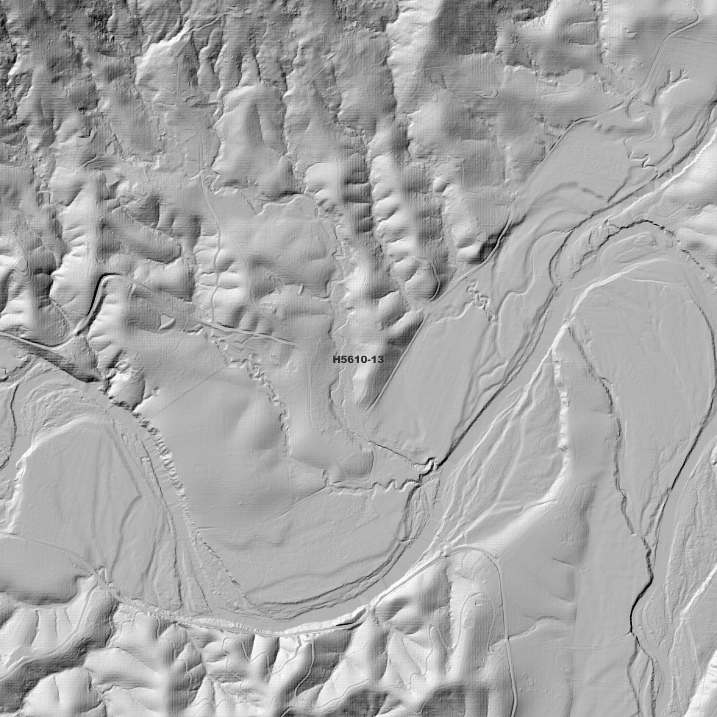
Bellingen 1m Digital Elevation Model (H5610-13)
Bellingen 1m Digital Elevation Model (H5610-13)
Couldn't load pickup availability
*Updated Product - March 2026*
Bellingen 1m Digital Elevation Model (H5610-13) – High-Precision Digital Elevation Model Data which has been highly curated and ready for use.
Elev Group presents our high-resolution Bellingen 1m Digital Elevation Model (DEM)—an easy-to-access resource for professionals needing precise terrain data for mapping, modelling, and spatial analysis.
What is in your Download
- 1 Metre resolution Digital Elevation Model (Geotiff format)
- Full Metadata Statement (PDF document)
- Metadata Index Dataset (ESRI Shapefile)
- Copies of original Metadata from each contributing data survey
Data Source Attribution: The 1m DEM is compiled from a variety of authoritative sources, with each pixel representing the most current elevation data for consistent and accurate geospatial analysis.
Bellingen 1m DEM (H5610-13) compiled with data supplied by CSIRO Land and Water; Spatial Services, a business unit of the Department of Customer Service, NSW, and NSW Government (Primary Industries and Regional Development).
Note: Data Gaps Exist Between Source Datasets
Projection: Zone 56 Map Grid of Australia and Datum: GDA2020
Locations
State and Territories: New South Wales
Locations within the area; Brierfield, Fernmount, Bellingen, Gleniffer, Thora, Valery, Megan, Charlmont, Crossmaglen, Dairyville, Buffer Creek, Aurania, Kooroowi, Killungoondie Plain, Leigh, Never Never Picnic Area, Tallowwood Point, Suicide, Sunny Corner, Upper Bobo, Marx Hill, Hampton Court, Gordonville, Promised Land, Scotchman, Dome Mountain, Mount Goobergooberyam, Mcgraths Hump, Tuckers Nob, Mount Wondurrigah, Mount Moombil, Mount Roogatargah, Gladstone, North Bellingen, Timboon, Wongawanga, Belmore, Stewart, South Bellingen, Brooklana, Upper Orara, Raleigh, Hydes Creek
Share