Elev Group Pty Ltd
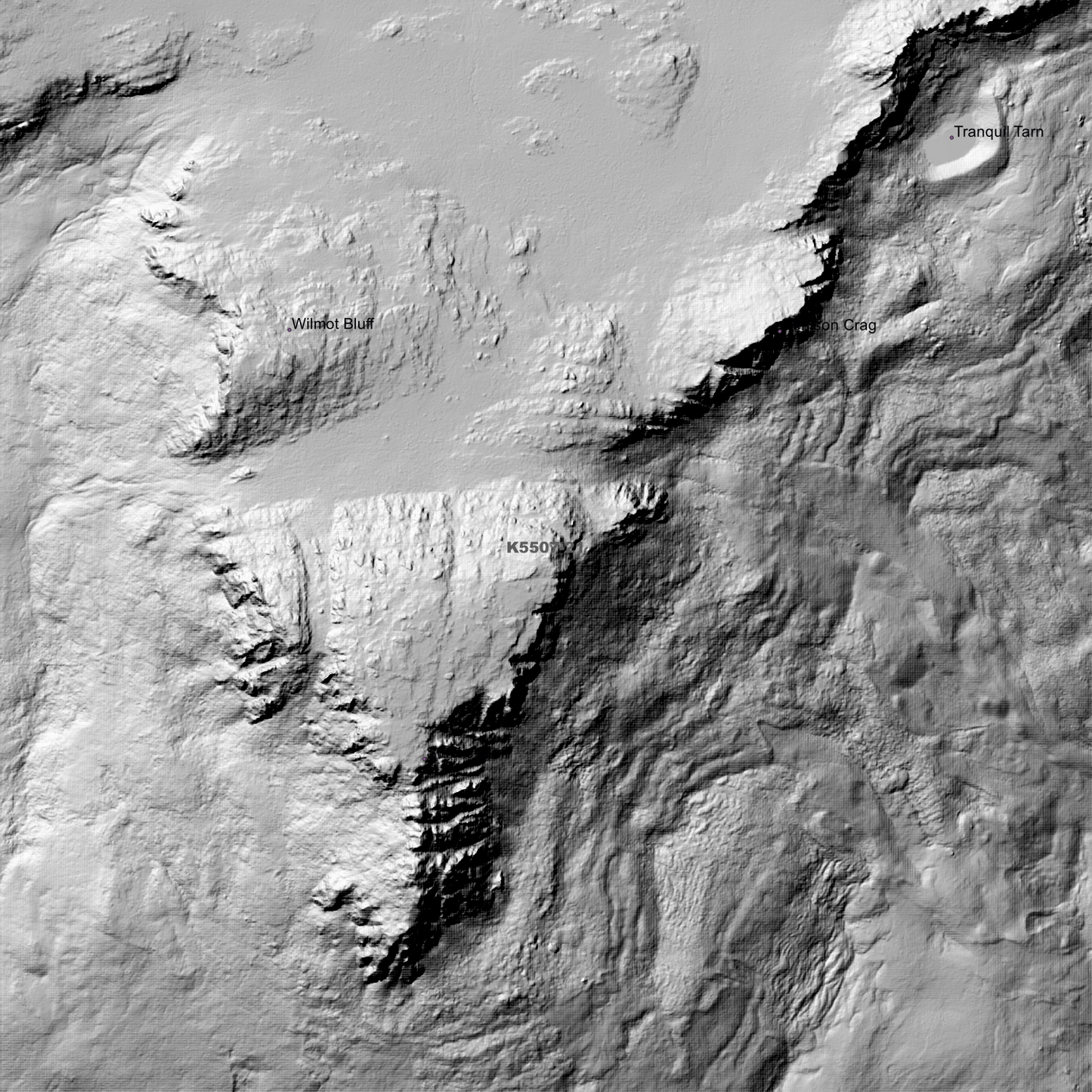
Ben Lomond 1m Digital Elevation Model (K5507-21)
Ben Lomond 1m Digital Elevation Model (K5507-21)
Couldn't load pickup availability
Ben Lomond 1m Digital Elevation Model (K5507-21) – High-Precision Digital Elevation Model Data which has been highly curated and ready for use.
Elev Group presents our high-resolution Ben Lomond 1m Digital Elevation Model (DEM)—an easy-to-access resource for professionals needing precise terrain data for mapping, modelling, and spatial analysis.
What is in your Download?
- 1 Metre resolution Digital Elevation Model (Geotiff format)
- Full Metadata Statement (PDF document)
- Metadata Index Dataset (ESRI Shapefile)
- Copies of original Metadata from each contributing data survey
Data Source Attribution: The 1m DEM is compiled from a variety of authoritative sources, with each pixel representing the most current elevation data for consistent and accurate geospatial analysis.
Ben Lomond 1m DEM (K5507-21) compiled with data supplied by The Department of Natural Resources and Environment Tasmania.
Projection: Zone 55 Map Grid of Australia and Datum: GDA2020
Locations
State and Territories: Tasmania
Locations within the area; Allen Heights, Asgard Crag, Bag and Rake Gully, Ben Lomond, Ben Lomond National Park, Bent Bluff, Big Opening, Bomford Crag, Borrowdale, Boundary Gully, Burleigh Gully, Coalmine Crag, Denison Crag, Devils Gully, Dillon Bottom, Dogshead Crag, English Town, Foster Vale, Heimdall Crag, Lake Baker, Lake Youl, Legges Tor, Long Valley, Magnet Crag, Markham Heights, Meadow Vale, Menamatta Tarns, Misery Bluff, Moss Gully, Mount Christie, Mount Rex, Myrtle Vale, New Cart Gully, Old Cart Gully, Ossians Throne, Pavement Bluff, Piesse Vale, Pork Chop Gully, Ragged Jack, Rodway Valley, Rossarden, Speke Gorge, Sphinx Bluff, Stacks Bluff, Storys Bluff, Storys Creek, Strickland Gorge, Surprise Vale, The Knuckle, Tranquil Tarn, Vale of Rest, Wilmot Bluff, Youls Tarn
Share