Elev Group Pty Ltd
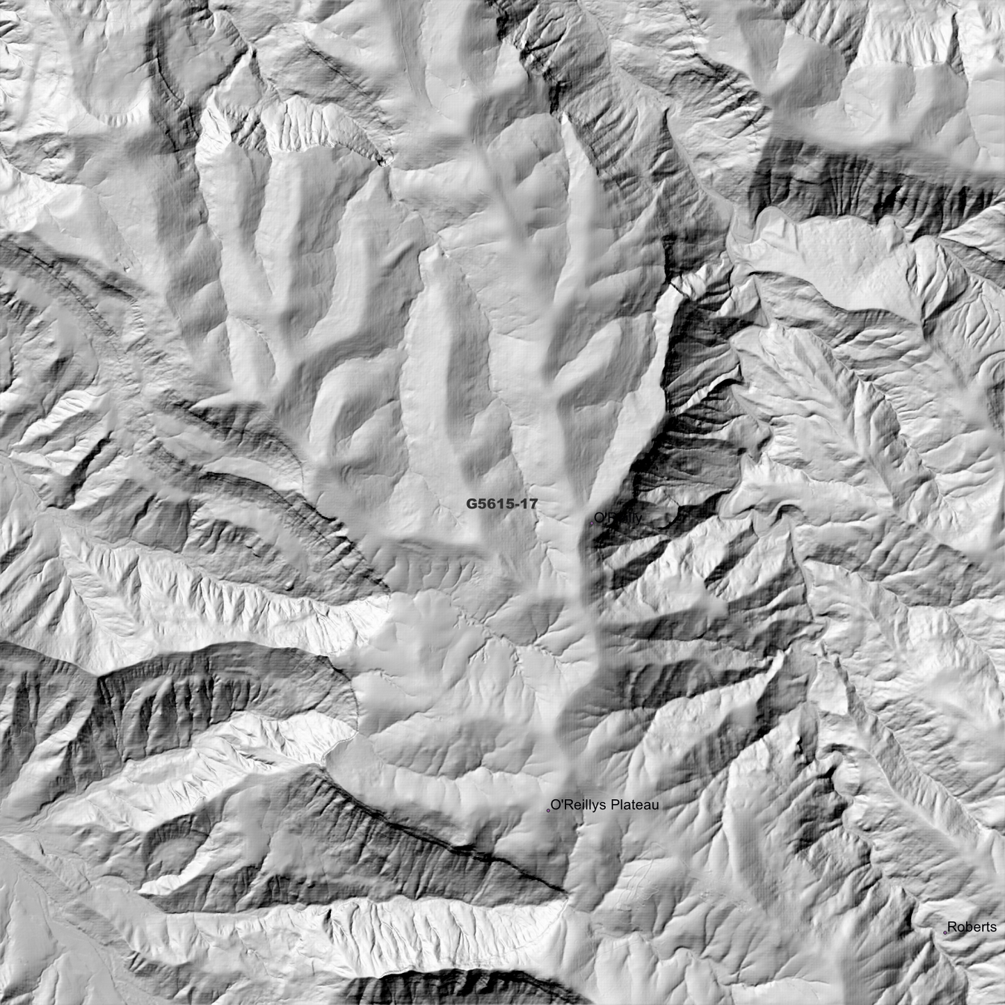
Binna 1m Digital Elevation Model (G5615-17)
Binna 1m Digital Elevation Model (G5615-17)
Couldn't load pickup availability
Binna 1m Digital Elevation Model (G5615-17) – High-Precision Digital Elevation Model Data which has been highly curated and ready for use.
Elev Group presents our high-resolution Binna 1m Digital Elevation Model (DEM)—an easy-to-access resource for professionals needing precise terrain data for mapping, modelling, and spatial analysis.
What is in your Download
- 1 Metre resolution Digital Elevation Model (Geotiff format)
- Full Metadata Statement (PDF document)
-
Metadata Index Dataset (ESRI Shapefile)
- Copies of original Metadata from each contributing data survey
Data Source Attribution: The 1m DEM is compiled from a variety of authoritative sources, with each pixel representing the most current elevation data for consistent and accurate geospatial analysis.
Binna 1m DEM (G5615-17) compiled with data supplied by State of Queensland & CSIRO Land and Water.
Projection: Zone 56 Map Grid of Australia and Datum: GDA2020
Locations
State and Territories: Queensland & New South Wales
Locations within the area; Beechmont, Binna Burra, Cainbable, Canungra, Ferny Glen, Flying Fox, Hillview, Illinbah, Kerry, Kurraragin Valley, Lower Beechmont, Moonlight Crag, Mount Alexander, Mount Merino, Mount Misery, Mount Roberts, Mount Tabragalba, Mount Tenduragan, Mount Witheren, Natural Bridge, Nindooinbah, Numinbah, Numinbah Valley, O'Reilly, O'Reillys Plateau, Roberts, Sarabah, Tenduragan, Turtle Rock, Witheren, Woggunba Valley, Wullo-Eerie
Share