Elev Group Pty Ltd
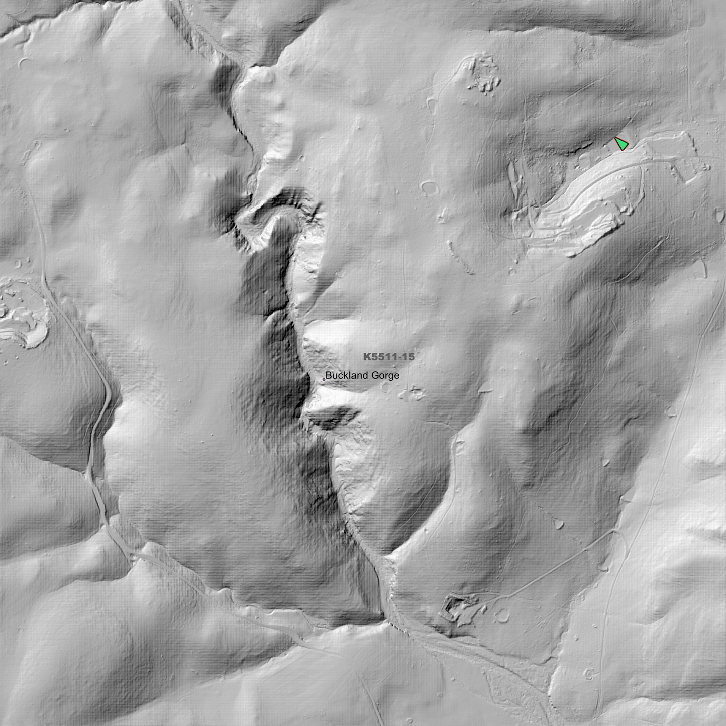
Buckland 1m Digital Elevation Model (K5511-15)
Buckland 1m Digital Elevation Model (K5511-15)
Couldn't load pickup availability
Buckland 1m Digital Elevation Model (K5511-15) – High-Precision Digital Elevation Model Data which has been highly curated and ready for use.
Elev Group presents our high-resolution Buckland 1m Digital Elevation Model (DEM)—an easy-to-access resource for professionals needing precise terrain data for mapping, modelling, and spatial analysis.
What is in your Download?
- 1 Metre resolution Digital Elevation Model (Geotiff format)
- Full Metadata Statement (PDF document)
- Metadata Index Dataset (ESRI Shapefile)
- Copies of original Metadata from each contributing data survey
Data Source Attribution: The 1m DEM is compiled from a variety of authoritative sources, with each pixel representing the most current elevation data for consistent and accurate geospatial analysis.
Buckland 1m DEM (K5511-15) compiled with data supplied by The Department of Natural Resources and Environment Tasmania, and Geoscience Australia
Note: Data Holes Exist within Source Datasets
Projection: Zone 55 Map Grid of Australia and Datum: GDA2020
Locations
State and Territories: Tasmania
Locations within the area; Badger Box Gully, Bluff River Gorge, Brown Mountain, Buckland, Buckland Gorge, Burrows Gully, Cat Gut Gully, Channel Gully, Crawlers Gully, Dark Gully, Grahams Gully, Grassy Bottom, Levendale, Marshall, Maynes Gully, Mosquito Valley, Mount Calder, Mount Calvary, Mount Douglas, Mount Gatehouse, Mount Hobbs, Mount Minnie, Mount Morrison, Mount Phipps, Mountain Gully, Nugent, Orielton, Pawleena, Pawleena Reservoir, Runnymede, Skeggs Gully, Square Mountain, Stringy Bark Bottom, Tier Gully, Tiger Trap Gully, Unemployed Gully
Share