Elev Group Pty Ltd
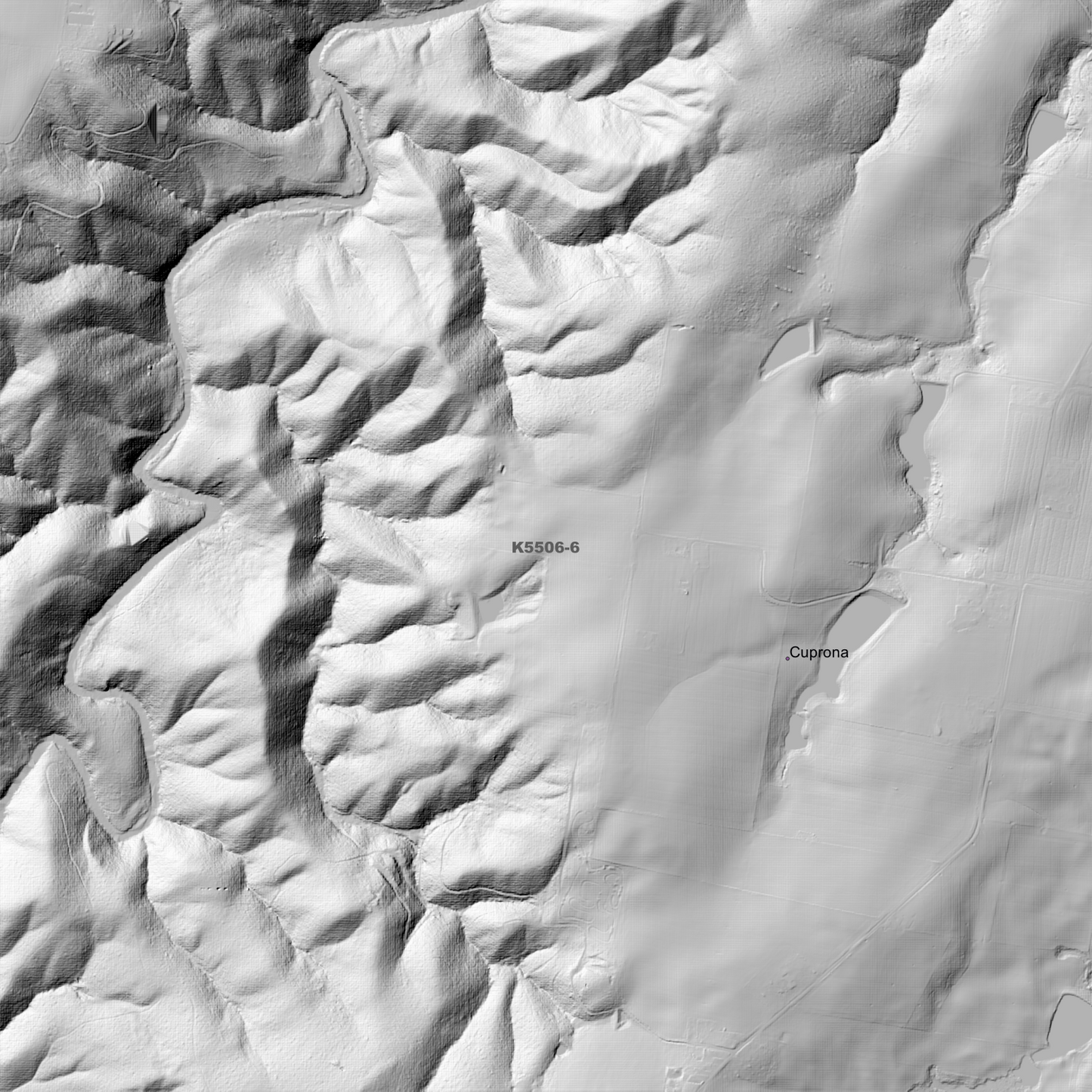
Burnie 1m Digital Elevation Model (K5506-6)
Burnie 1m Digital Elevation Model (K5506-6)
Couldn't load pickup availability
Burnie 1m Digital Elevation Model (K5506-6) – High-Precision Digital Elevation Model Data which has been highly curated and ready for use.
Elev Group presents our high-resolution Burnie 1m Digital Elevation Model (DEM)—an easy-to-access resource for professionals needing precise terrain data for mapping, modelling, and spatial analysis.
What is in your Download?
- 1 Metre resolution Digital Elevation Model (Geotiff format)
- Full Metadata Statement (PDF document)
- Metadata Index Dataset (ESRI Shapefile)
- Copies of original Metadata from each contributing data survey
Data Source Attribution: The 1m DEM is compiled from a variety of authoritative sources, with each pixel representing the most current elevation data for consistent and accurate geospatial analysis.
Burnie 1m DEM (K5506-6) compiled with data supplied by The Department of Natural Resources and Environment Tasmania, and Geoscience Australia
Projection: Zone 55 Map Grid of Australia and Datum: GDA2020
Locations
State and Territories: Tasmania
Locations within the area; Acton, Broadridge, Brooklyn, Burnie, Camdale, Camena, Chasm Creek, Cooee, Cuprona, Doctors Rocks, Downlands, East Cam, East Ridgley, Elliott, Emu Heights, Fern Glade, Glance Creek, Guide Reservoir, Havenview, Havenview Reservoir, Heybridge, Highclere, Hillcrest, Mont Albert Reservoir, Montello, Mooreville, Natone, Ocean Vista, Park Grove, Parklands, Pet Reservoir, Riana, Ridgley, Romaine, Romaine Reservoir, Round Hill, Shorewell Park, Somerset, South Burnie, South Elliott, South Riana Lake, Stowport, Upper Burnie, Upper Natone, Upper Stowport, West Mooreville, West Ridgley, Wivenhoe
Share