Elev Group Pty Ltd
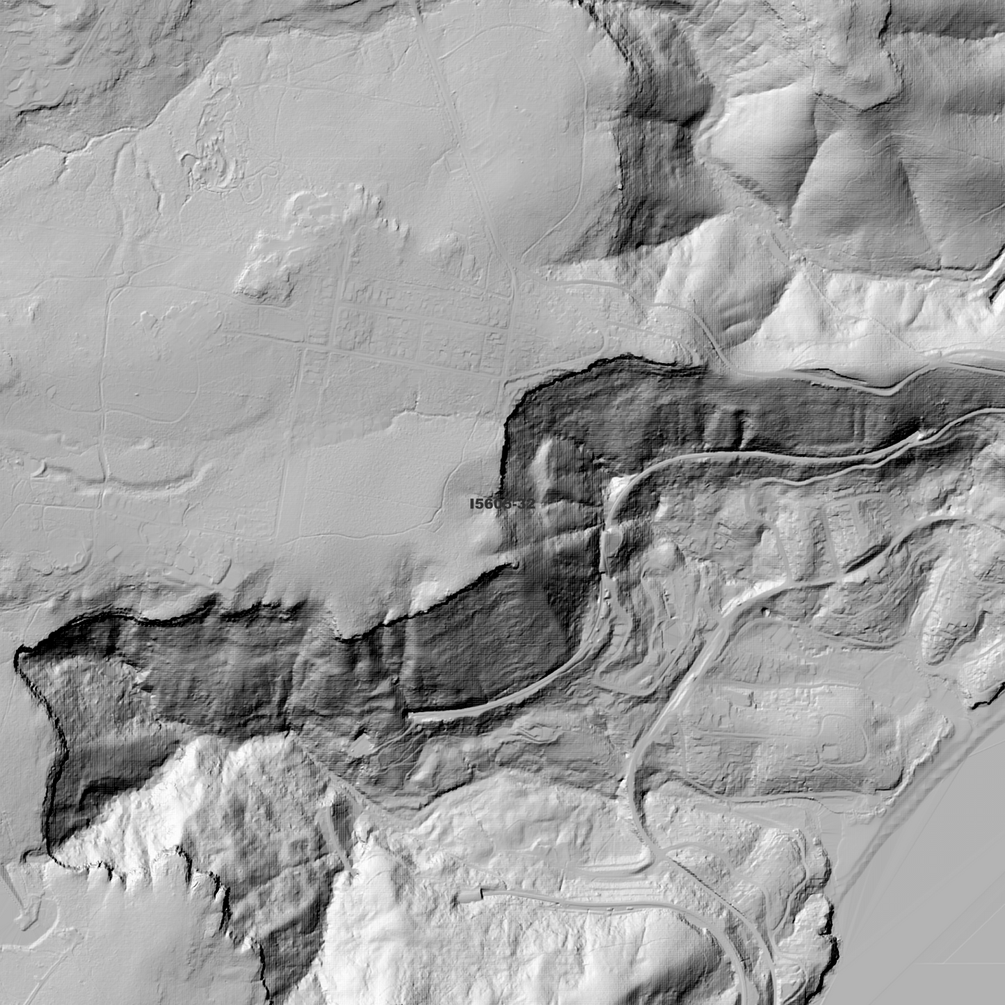
Campbelltown 1m Digital Elevation Model (I5605-32)
Campbelltown 1m Digital Elevation Model (I5605-32)
Couldn't load pickup availability
Campbelltown 1m Digital Elevation Model (I5605-32) – High-Precision Digital Elevation Model Data which has been highly curated and ready for use.
Elev Group presents our high-resolution Campbelltown 1m Digital Elevation Model (DEM)—an easy-to-access resource for professionals needing precise terrain data for mapping, modelling, and spatial analysis.
What is in your Download
- 1 Metre resolution Digital Elevation Model (Geotiff format)
- Full Metadata Statement (PDF document)
- Metadata Index Dataset (ESRI Shapefile)
- Copies of original Metadata from each contributing data survey
Data Source Attribution: The 1m DEM is compiled from a variety of authoritative sources, with each pixel representing the most current elevation data for consistent and accurate geospatial analysis.
Campbelltown 1mDEM (I5605-32) compiled with data supplied by NSW Government - Spatial Services.
Projection: Zone 56 Map Grid of Australia and Datum: GDA2020
Locations
State and Territories: New South Wales
Locations within the area; Woronora Dam, Coalcliff Dam, Lake Toolooma, Stanwell Dam, Arbon Vale, Wedderburn State Forest, Campbelltown, Coalcliff, Appin, Helensburgh, Stanwell Park, Stanwell Tops, Giles Junction, Glenlee, Little Forest, The Woolwash, Morella Karong, Flat Rock Junction, Harris Forest, Lake Currans, Thomson Lake, Lake Yandel'ora, Lake Woronora, Park Central, Mount Morella, Eckersley, Appin, Menangle, Wedderburn, Heathcote, St Peter, Claymore, Campbelltown, Currans Hill, Ambarvale, Airds, Eagle Vale, Eschol Park, Englorie Park, Woronora Dam, Coalcliff, Helensburgh, Stanwell Park, Stanwell Tops, Gledswood Hills, Bradbury, Bow Bowing, Blair Athol, Rosemeadow, Darkes Forest, Gilead, Glen Alpine, Kearns, Kentlyn, Leumeah, Long Point, Lucas Heights, Menangle Park, Wedderburn, Waterfall, Varroville, Woodbine, Minto, Minto Heights, Mount Annan, Raby, Ruse, St Andrews, St Helens Park, Smeaton Grange, Blairmount
Share