Elev Group Pty Ltd
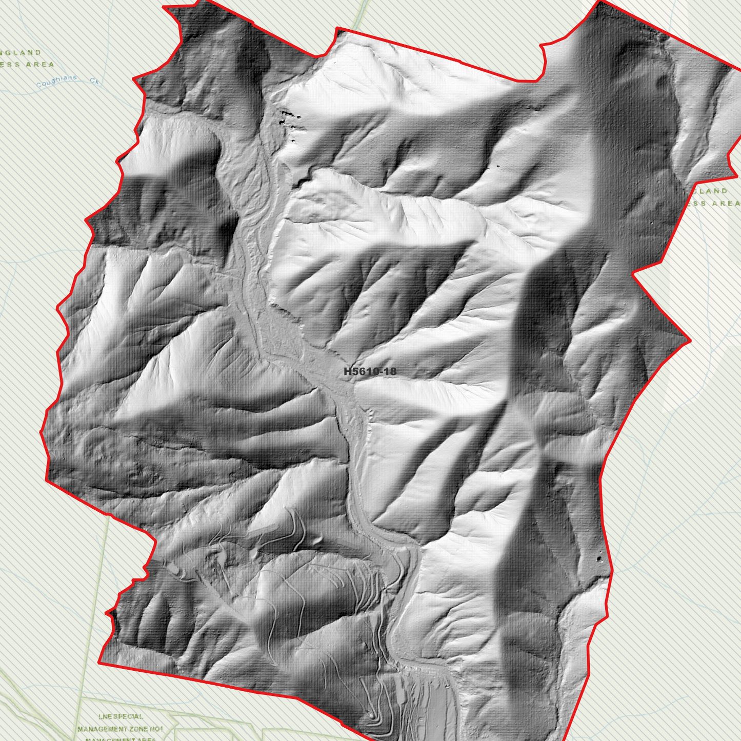
Comara 1m Digital Elevation Model (H5610-18)
Comara 1m Digital Elevation Model (H5610-18)
Couldn't load pickup availability
Comara 1m Digital Elevation Model (H5610-18)
Comara 1m Digital Elevation Model (H5610-18) – High-Precision Digital Elevation Model Data which has been highly curated and ready for use.
Elev Group presents our high-resolution Comara 1m Digital Elevation Model (DEM)—an easy-to-access resource for professionals needing precise terrain data for mapping, modelling, and spatial analysis.
What is in your Download
- 1 Metre resolution Digital Elevation Model (Geotiff format)
- Full Metadata Statement (PDF document)
- Metadata Index Dataset (ESRI Shapefile)
- Copies of original Metadata from each contributing data survey
Data Source Attribution: The 1m DEM is compiled from a variety of authoritative sources, with each pixel representing the most current elevation data for consistent and accurate geospatial analysis.
Comara 1m DEM (H5610-18) compiled with data supplied by NSW Government (Natural Resources Commission)
Projection: Zone 56 Map Grid of Australia and Datum: GDA2020
Locations
State and Territories: New South Wales
Locations within the area; Five Day Creek, Round Camp, Mount Comara, Robertsons Knob, Alum Mountain, Mount Woorong Woorong, Yellow Knob, Flying Fox Mountain, Pine Knob, Bitter Vine Mountain, Hawes Knob, Jobs Mountain, Shingley Mountain, Cliffs, Cochrane, Comara, Cunnawarra, Wolseley, Dyke, Nulla Nulla, Stuart, Mowle, Pee Dee, Lower Creek
Share