Elev Group Pty Ltd
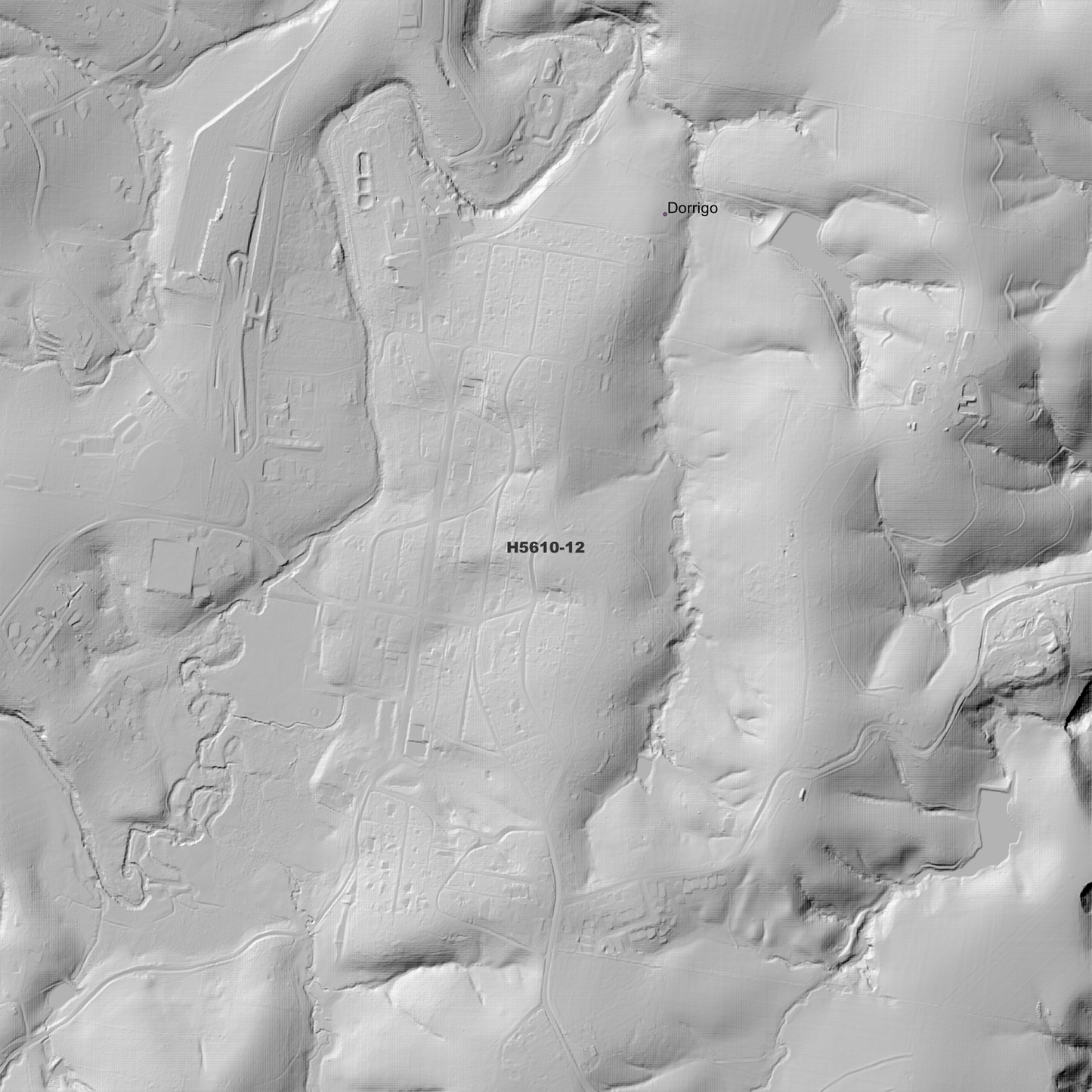
Dorrigo 1m Digital Elevation Model (H5610-12)
Dorrigo 1m Digital Elevation Model (H5610-12)
Couldn't load pickup availability
Dorrigo 1m Digital Elevation Model (H5610-12) – High-Precision Digital Elevation Model Data which has been highly curated and ready for use.
Elev Group presents our high-resolution Dorrigo 1m Digital Elevation Model (DEM)—an easy-to-access resource for professionals needing precise terrain data for mapping, modelling, and spatial analysis.
What is in your Download
- 1 Metre resolution Digital Elevation Model (Geotiff format)
- Full Metadata Statement (PDF document)
- Metadata Index Dataset (ESRI Shapefile)
- Copies of original Metadata from each contributing data survey
Data Source Attribution: The 1m DEM is compiled from a variety of authoritative sources, with each pixel representing the most current elevation data for consistent and accurate geospatial analysis.
Dorrigo 1m DEM (H5610-12) compiled with data supplied by CSIRO Land and Water
Projection: Zone 56 Map Grid of Australia and Datum: GDA2020
Locations
State and Territories: New South Wales
Locations within the area; Bostobrick, Dorrigo, North Dorrigo, Gangara, Maiden Scrub, The Black Scrub, The Glade, Tin Hut, Tree Fern Vale, Upper Thora, Woods Camp, Maynards Plains, Muldiva, Mountain Top, Orama, Harness Cask, Bens Hut, Paddys Plains, Rocky Creek, Mount Campion, Christophersons Mountain, Guubuny Mountain, Fenton, Bligh, Dudley, Dingle, Meldrum Downs, Oakes, Vautin, Fernbrook, Deer Vale, Brinerville, Bielsdown Hills, Dorrigo Mountain, Darkwood
Share