Elev Group Pty Ltd
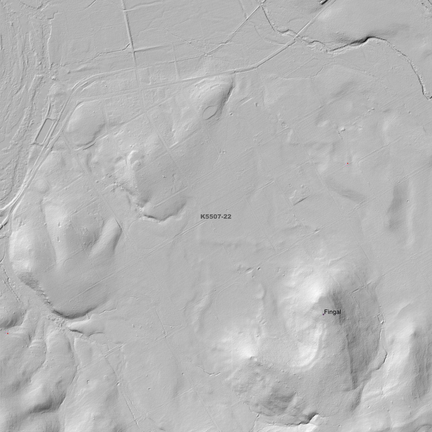
Fingal 1m Digital Elevation Model (K5507-22)
Fingal 1m Digital Elevation Model (K5507-22)
Couldn't load pickup availability
Fingal 1m Digital Elevation Model (K5507-22) – High-Precision Digital Elevation Model Data which has been highly curated and ready for use.
Elev Group presents our high-resolution Fingal 1m Digital Elevation Model (DEM)—an easy-to-access resource for professionals needing precise terrain data for mapping, modelling, and spatial analysis.
What is in your Download?
- 1 Metre resolution Digital Elevation Model (Geotiff format)
- Full Metadata Statement (PDF document)
- Metadata Index Dataset (ESRI Shapefile)
- Copies of original Metadata from each contributing data survey
Data Source Attribution: The 1m DEM is compiled from a variety of authoritative sources, with each pixel representing the most current elevation data for consistent and accurate geospatial analysis.
Fingal 1m DEM (K5507-22) compiled with data supplied by The Department of Natural Resources and Environment Tasmania.
Note: Data Gaps Exist within Source Datasets
Projection: Zone 55 Map Grid of Australia and Datum: GDA2020
Locations
State and Territories: Tasmania
Locations within the area; Alexandra, Black Horse Gully, Breakneck Gully, Broken Bluff, Calders Gully, Downings Gully, Fingal, Fingal Valley, Fords Gully, Golden Gully, Harrisons Gully, Hobbs Basin, Iron Pot Gully, Irvines Gully, Little Golden Gully, Long Gully, Majors Gully, Mangana, Maudwidt Gully, Moonameeta, Mount Clara, Mount Edgecumbe, Mount Foster, Musk Gully, Sailors Gully, Scotties Bottom, Sharkeys Gully, Sheepwash Gully, Tower Hill, Trotters Valley
Share