Elev Group Pty Ltd
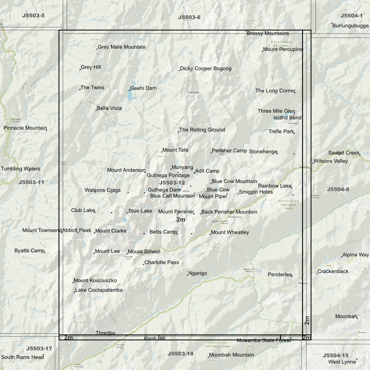
Kosciuszko 2m Digital Elevation Models (J5503-12)
Kosciuszko 2m Digital Elevation Models (J5503-12)
Couldn't load pickup availability
Kosciuszko 2m Digital Elevation Model (J5503-12) – High-Precision Digital Elevation Model Data which has been highly curated and ready for use.
Elev Group presents our high-resolution Kosciuszko 2m Digital Elevation Model (DEM)—an easy-to-access resource for professionals needing precise terrain data for mapping, modelling, and spatial analysis.
What is in your Download
- 2 Metre resolution Digital Elevation Model (Geotiff format) (Full Coverage)
- Full Metadata Statements (PDF document)
- Metadata Index Datasets (ESRI Shapefile)
- Copies of original Metadata from each contributing data survey
Data Source Attribution: The 2m DEM have been compiled from a variety of authoritative sources, with each pixel representing the most current elevation data for consistent and accurate geospatial analysis.
Kosciuszko 2m DEM (J5503-12) compiled with data supplied by Spatial Services, a business unit of the Department of Customer Service, NSW.
Capture Method: 2m Lidar
Projection: Zone 55 Map Grid of Australia and Datum: GDA2020
Note: Data Gaps Exist within Source Datasets
State and Territories: New South Wales
Locations within the area; Abbott Peak, Adit Camp, Albina Lake, Back Perisher Mountain, Bella Vista, Betts Camp, Blue Calf Mountain, Blue Cow, Blue Cow Mountain, Blue Lake, Charlotte Pass, Club Lake, Dicky Cooper Bogong, Friday Flat Camp, Geehi Dam, Geehi Reservoir, Green Rock, Grey Hill, Grey Mare Mountain, Guthega, Guthega Dam, Guthega Pondage, Harveys Camp, Hedley Tarn, Island Bend, Island Bend Pondage, Knob Hill, Lake Cootapatamba, Mount Anderson, Mount Anton, Mount Clarke, Mount Guthrie, Mount Kosciuszko, Mount Lee, Mount Northcote, Mount Perisher, Mount Piper, Mount Porcupine, Mount Sentinel, Mount Stilwell, Mount Tate, Mount Townsend, Mount Twynam, Mount Wheatley, Mowamba State Forest, Munyang, Ngarigo, Penderlea, Perisher Camp, Perisher Valley, Rainbow Lake, Smiggin Holes, Stonehenge, The Long Corner, The Paralyser, The Rolling Ground, The Twins, Thredbo, Three Mile Glen, Trefle Park, Watsons Crags
Image Descriptions
- 2m DEM Image identifying resolution area’s (Single Band Pseudocolour Quantile)
- 2m DEM image – Hillshade
- 2m Metadata Index with date label.
- 2m Data Zoom (1:20000)
- No Product Data turned on, Just Map Display Background.
Share