Porcupine 1m, 2m & 5m Digital Elevation Models (I5515-20) – High-Precision Digital Elevation Model Data which has been highly curated and ready for use.
Elev Group presents our high-resolution Porcupine 1m, 2m & 5m Digital Elevation Models (DEM)—an easy-to-access resource for professionals needing precise terrain data for mapping, modelling, and spatial analysis.
What is in your Download
- 1 Metre resolution Digital Elevation Model (Geotiff format) (Partial Coverage)
- 2 Metre resolution Digital Elevation Model (Geotiff format) (Partial Coverage)
- 5 Metre resolution Digital Elevation Model (Geotiff format) (Full Coverage)
- Full Metadata Statements (PDF document)
- Metadata Index Datasets (ESRI Shapefile)
- Copies of original Metadata from each contributing data survey
Data Source Attribution: The 1m, 2m & 5m DEMs have been compiled from a variety of authoritative sources, with each pixel representing the most current elevation data for consistent and accurate geospatial analysis.
Porcupine 1m, 2m & 5m DEMs (I5515-20) compiled with data supplied by Spatial Services, a business unit of the Department of Customer Service, NSW.
Capture Method: 1m – LiDAR, 2m - LiDAR, 5m – LiDAR and Photogrammetry
Projection: Zone 55 Map Grid of Australia and Datum: GDA2020
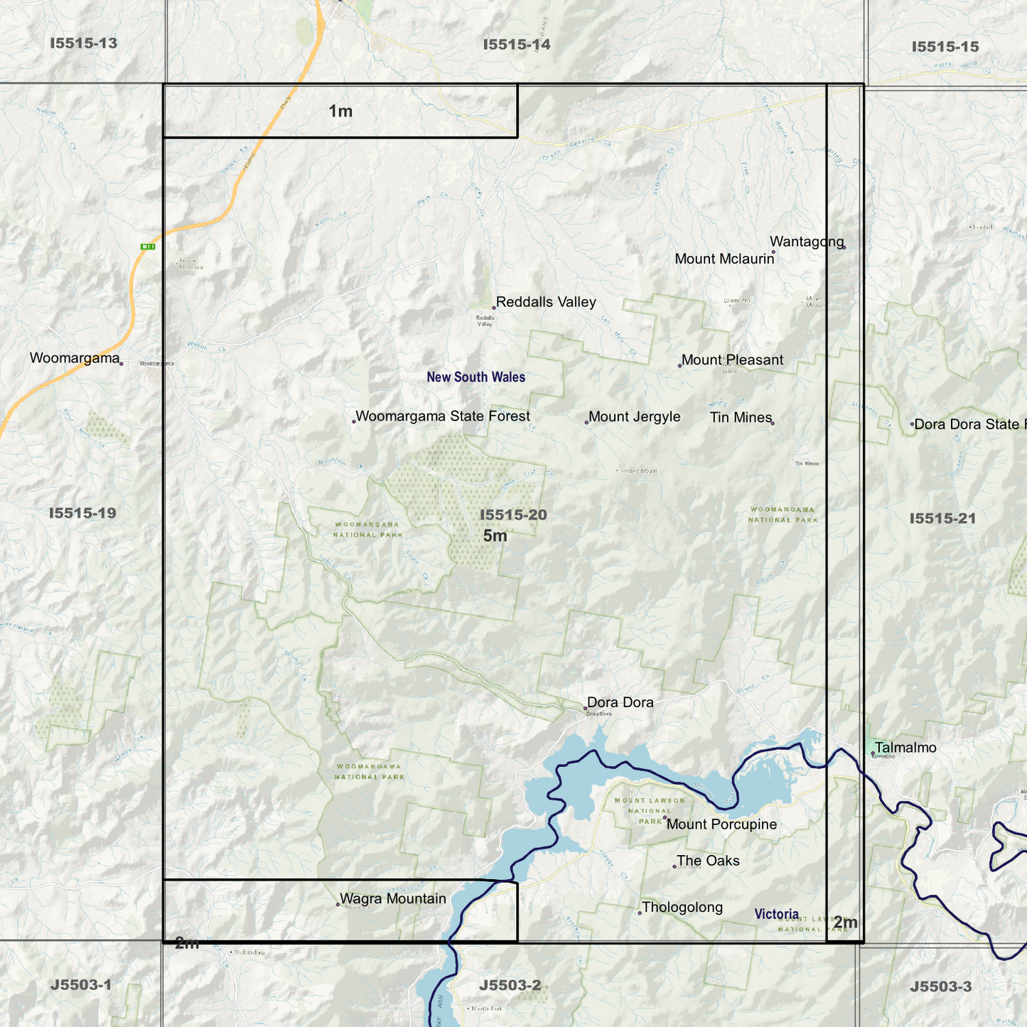
State and Territories: New South Wales and Victoria
Locations within the area; Dora Dora, Mount Jergyle, Mount Mclaurin, Mount Pleasant, Mount Porcupine, Reddalls Valley, The Oaks, Tin Mines, Wagra Mountain, Woomargama State Forest
Image Descriptions
- DEM Image identifying 1m 2m and 5m Area’s (Single Band Pseudocolour Quantile)
- 1m DEM image – Single Band Pseudocolour Quantile
- 1m DEM image – Hillshade
- 1m Metadata Index with date label.
- 1m Data Zoom (1:10000)
- 2m DEM image – Single Band Pseudocolour Quantile
- 2m DEM image – Hillshade
- 2m Metadata Index with date label.
- 2m Data Zoom (1:20000)
- 5m DEM image – Single Band Pseudocolour Quantile
- 5m DEM image – Hillshade
- 5m Metadata Index with date label.
- 5m Data Zoom (1:50000)
- No Product Data turned on, Just Map Display Background.