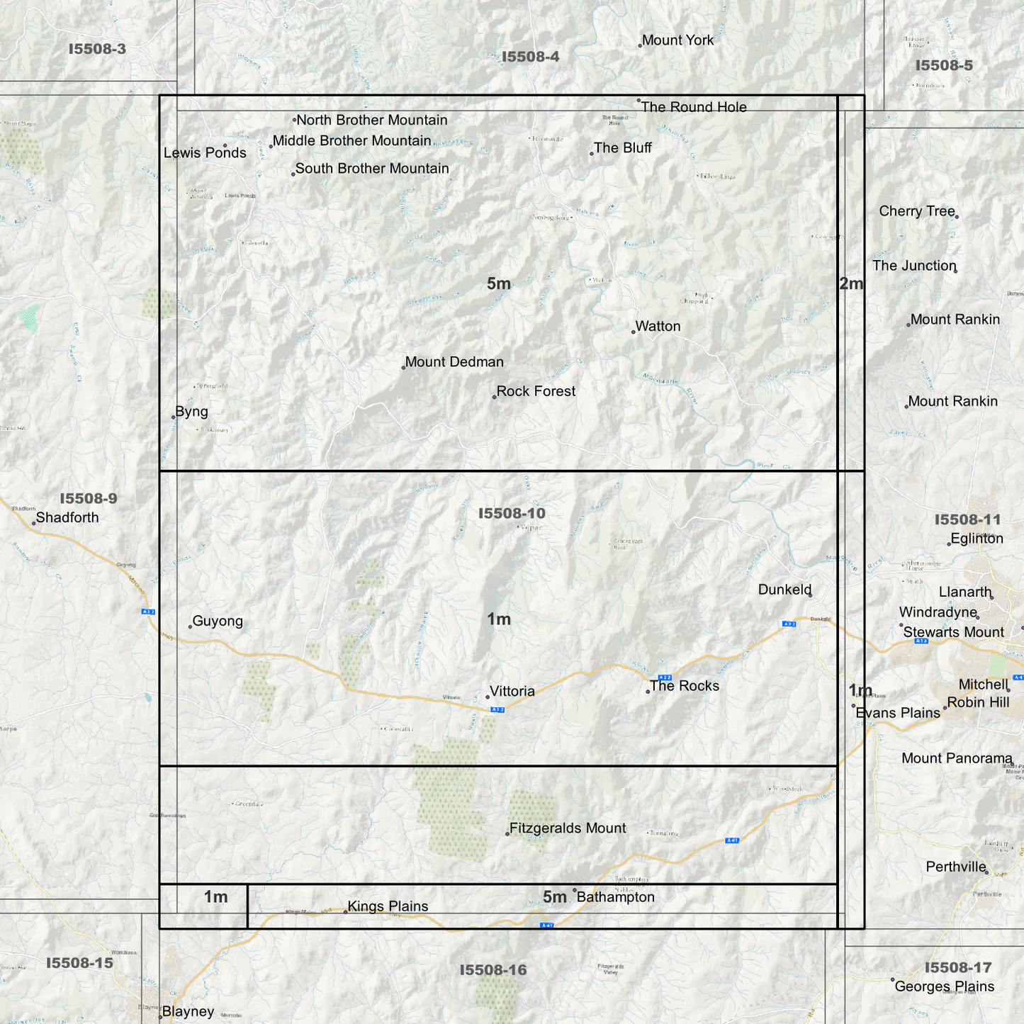
Vittoria 1m, 2m & 5m Digital Elevation Models (I5508-10) – High-Precision Digital Elevation Model Data which has been highly curated and ready for use.
Elev Group presents our high-resolution Vittoria 1m, 2m & 5m Digital Elevation Models (DEM)—an easy-to-access resource for professionals needing precise terrain data for mapping, modelling, and spatial analysis.
What is in your Download
- 1 Metre resolution Digital Elevation Model (Geotiff format) (Partial Coverage)
- 2 Metre resolution Digital Elevation Model (Geotiff format) (Partial Coverage)
- 5 Metre resolution Digital Elevation Model (Geotiff format) (Full Coverage)
- Full Metadata Statements (PDF document)
- Metadata Index Datasets (ESRI Shapefile)
- Copies of original Metadata from each contributing data survey
Data Source Attribution: The 1m, 2m & 5m DEMs have been compiled from a variety of authoritative sources, with each pixel representing the most current elevation data for consistent and accurate geospatial analysis.
Vittoria 1m, 2m & 5m DEMs (I5508-10) compiled with data supplied by Spatial Services, a business unit of the Department of Customer Service, NSW.
Capture Method: 1m – LiDAR, 2m - Lidar, 5m – LiDAR and Photogrammetry
Projection: Zone 55 Map Grid of Australia and Datum: GDA2020
Note: Data Gaps Exist within Source Datasets
State and Territories: New South Wales
Locations within the area; Bathampton, Billywillinga, Byng, Dunkeld, Fitzgeralds Mount, Freemantle, Guyong, Kings Plains, Lewis Ponds, Middle Brother Mountain, Milkers Flat, Mount Dedman, North Brother Mountain, Pointed Brother Mountain, Rock Forest, South Brother Mountain, The Bluff, The Rocks, Vittoria, Vittoria State Forest, Watton
Image Descriptions
- DEM Image identifying 1m 2m and 5m Area’s (Single Band Pseudocolour Quantile)
- 1m DEM image – Single Band Pseudocolour Quantile
- 1m DEM image – Hillshade
- 1m Metadata Index with date label.
- 1m Data Zoom (1:10000)
- 2m DEM image – Single Band Pseudocolour Quantile
- 2m DEM image – Hillshade
- 2m Metadata Index with date label.
- 2m Data Zoom (1:20000)
- 5m DEM image – Single Band Pseudocolour Quantile
- 5m DEM image – Hillshade
- 5m Metadata Index with date label.
- 5m Data Zoom (1:50000)
- No Product Data turned on, Just Map Display Background.