Elev Group Pty Ltd
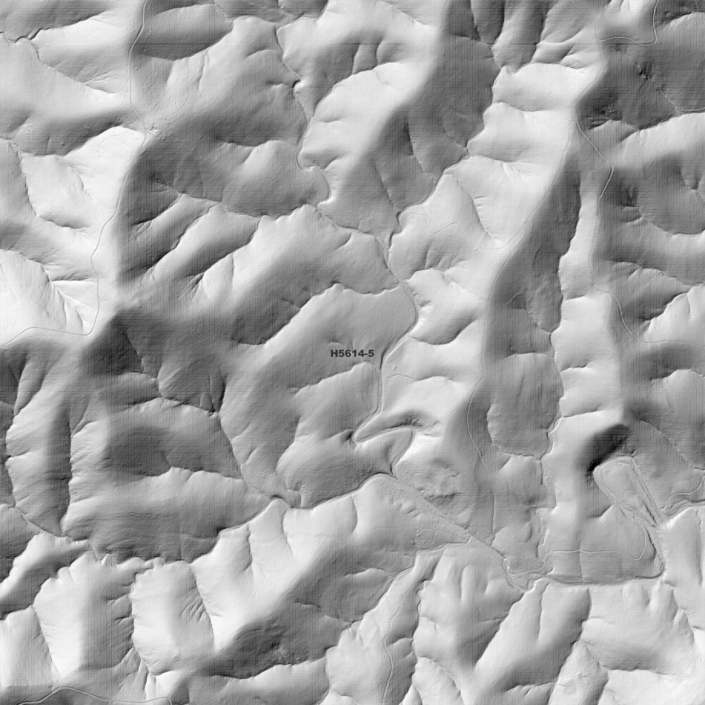
Yarravel 1m Digital Elevation Model (H5614-5)
Yarravel 1m Digital Elevation Model (H5614-5)
Couldn't load pickup availability
*Updated Product - Sept 2025*
Yarravel 1m Digital Elevation Model (H5614-5) – High-Precision Digital Elevation Model Data which has been highly curated and ready for use.
Elev Group presents our high-resolution Yarravel 1m Digital Elevation Model (DEM)—an easy-to-access resource for professionals needing precise terrain data for mapping, modelling, and spatial analysis.
What is in your Download
- 1 Metre resolution Digital Elevation Model (Geotiff format)
- Full Metadata Statement (PDF document)
- Metadata Index Dataset (ESRI Shapefile)
- Copies of original Metadata from each contributing data survey
Data Source Attribution: The 1m DEM is compiled from a variety of authoritative sources, with each pixel representing the most current elevation data for consistent and accurate geospatial analysis.
Yarravel 1m DEM (H5614-5) compiled with data supplied by NSW Government - Spatial Services, NSW Government (Natural Resources Commission) and NSW Government (Primary Industries and Regional Development).
Projection: Zone 56 Map Grid of Australia and Datum: GDA2020
Locations
State and Territories: New South Wales
Locations within the area;Steuart Mcintyre Dam, Battles Outlet, Boonanghi, Belgrave Falls, Gearys Mountain, Mount Kippara, Tuckybunyubah Mountain, Tinebank Mountain, Mount Motherabah, Flat Top Mountain, Corangula, Yarravel, Kippara, Upper Rollands Plains, Marlo Merrican, Wittitrin, Dondingalong, Yessabah, Gearys Flat, Turners Flat, Mooneba, Sherwood, Skillion Flat
Share